|
By JOE CARTWRIGHT
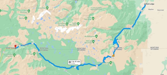
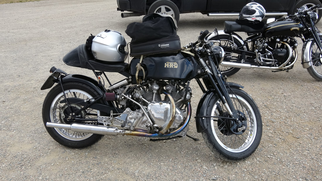
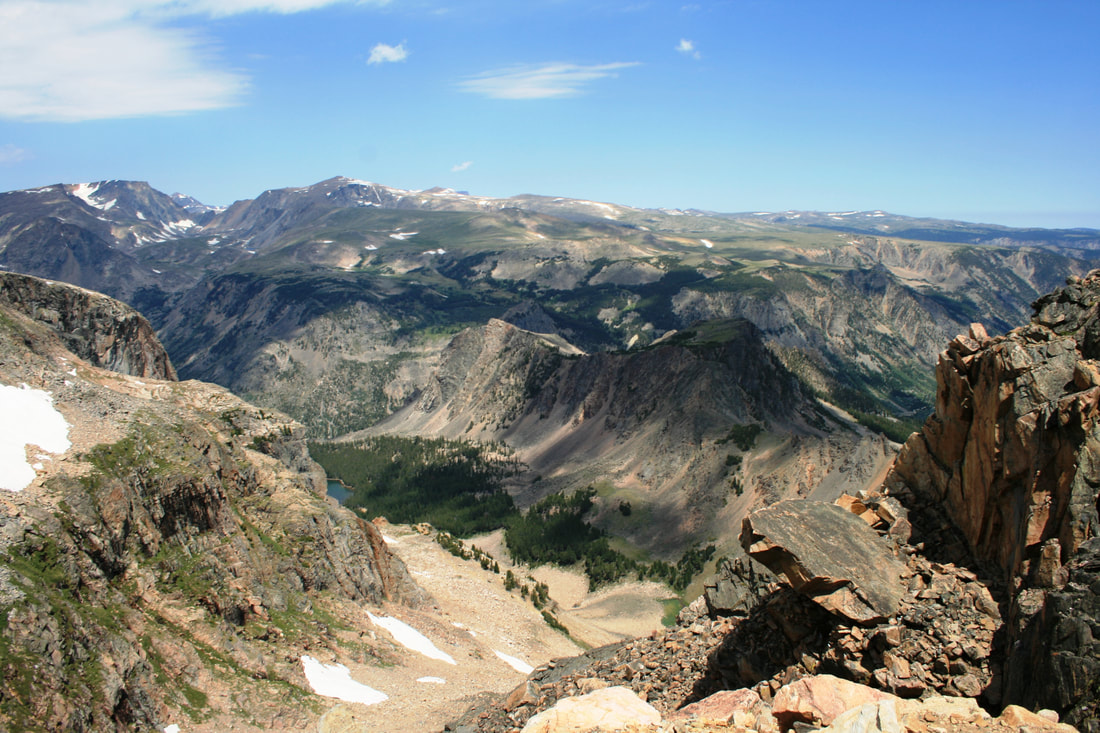
Special to North Palm Beach Life August, 2019. THE BEST ROAD IN AMERICA is not a title given lightly. Especially, since my first solo trip across the highway was almost my last trip, period. The Beartooth Highway is a section of US Highway 212 that connects Yellowstone National Park with the Billings, Montana area. Beginning at the Northeast Entrance to Yellowstone Park, the highway curls and climbs a 70-mile path all the way to Red Lodge, Montana. The crest of the highway, Beartooth Pass, is a 10,947 foot- summit that can change from jaw-dropping beauty to hypothermia very quickly. The highway winds through some of the most beautiful territory in America. There are overlooks where you feel you can look forever. The higher elevations of the highway usually have snow – adjacent to the road – year-round. The wildlife is shy and usually stays a distance away, but it is there: Bighorn sheep, mountain goats, deer, elk, and many others. The highway can be negotiated by most any vehicle that is highway-legal, but drivers with large motorhomes or long travel trailers won’t have much fun on the multitude of switchbacks scattered along the highway. Construction of the highway began in 1931, at the height of the Great Depression. The new Beartooth Highway opened in 1936 and has a relatively short season of use: Typically from mid-May until mid-October – if the weather cooperates. The highway attracts all manner of travelers, and it is very popular for motorcyclists. In one recent trip over the highway, we met two motorcyclists (from Tennessee and Kentucky) touring the highway in a classic British fashion. One cyclist was riding an immaculate 1948 Vincent H-R-D, and his friend was on perhaps the most iconic motorcycle ever made -- a 1950 Vincent Black Shadow. Today, a ratty, worn-down Black Shadow will bring $100,000 and one that looks like the example we saw is easily in the $200,000 (and up) range. The riders said that they were headed for a Vincent owners rally in the area. If you're traveling from Yellowstone National Park, Beartooth Highway begins as you leave Yellowstone from its Northeast Entrance. First you pass through the tiny gateway communities of Silver Gate and Cooke City, Montana. (When the Yellowstone forest fires of 1988 were bearing down on Cooke City, a resident with a bleak sense of humor changed the city limits sign to “Cooked City”.) DURING THE WINTER, the highway from Cooke City to Yellowstone’s north entrance at Gardiner, Montana is kept open with snowplows. Families live in Cooke City and Silver Gate (about 75 people, year-round; 250 or more in the summer) and their kids have to go to school. Now, Cooke City has its own school, equipped for K to grade 8. The current school population is three students and one teacher. For grades 9 – 12, the kids are bused every day, 55 miles each way, to Gardiner High School. One landmark about 10 wilderness miles north of Cooke City is Grasshopper Glacier. Named for tens of millions of grasshoppers (locusts, actually) that became entombed in the glacier’s ice, the glacier can be accessed only after a rough trip on an ATV trail, followed by a long hike of several miles. Those who make this trip are rewarded by a beautiful view, plus (possibly) the sight of thawed, prehistoric grasshoppers scattered around on the ground, but not much of a glacier is left. Beartooth Highway continues climbing and wanders back and forth over the Wyoming/Montana border. During most of these miles, Pilot Peak and Index Peak loom large on the western horizon. Pilot Peak is a prominent, pyramid-shaped mountain that served as a landmark for early travelers. Index Peak is – supposedly – named because it looks like an index finger pointing upward. If that is true, someone had extremely stubby fingers. Of course, the Grand Tetons were said to be named for their resemblance to the figure of a woman laying down, so, you never know . . . About 12 miles out of Cooke City, the highway crosses Crazy Creek. Crazy Creek best lives up to its name during the spring and early summer, when it it so broad it looks more like a whole lake tumbling down the mountain side. From there, the highway winds back and forth from one spectacular view to another. National Forest campgrounds are scattered all along the route. About 17 miles out of Cooke City, the Chief Joseph Scenic Highway (also known as the Sunlight Basin Road) takes off toward Cody, Wyoming. This beautiful road passes through valleys dotted with working cattle ranches as you travel the 46 miles from the Beartooth Highway to Cody, Wyoming. The last time we traveled the Chief Joseph Highway, it was being used as a staging area for massive forest fires in the area. Through traffic was allowed, but drivers were cautioned to watch for fire fighting equipment on the highway. Beartooth Butte and Beartooth Lake are popular stops along the way. About 24 miles from Cooke City is the Top-Of-The-World Resort; at an elevation of 9,400 feet, the lodge and adjoining store are the only source for food, fuel, lodging, and supplies for most of the highway’s length. Between Cooke City and Beartooth Pass, the highway winds through even more spectacular scenery. The road flattens out somewhat in the area atop Beartooth Plateau as you near Beartooth Pass. A few miles before the pass, drivers cross the timberline: Above that elevation (about 9,500 feet, at this latitude) few if any trees can grow due to the long, harsh winters and overall severe conditions. The last trees you see before timberline are stunted, twisted pine, spruce, and fir. JUST BEYOND BEARTOOTH PASS is the Beartooth Basin Summer Ski Area. In 2019, this ski area is scheduled to be open from June 15 to July 7, depending on weather conditions. Operated by permit within Shoshone National Forest, the ski area has two lifts and nine trails, but few (if any) other facilities. Also visible from this area is a one particular peak on the western horizon: The Bear’s Tooth. And yes, it does actually look like one. Beyond the Pass, however, the highway begins a descent into Rock Creek Canyon. The Rock Creek Overlook is a short walk from a large parking area, and the view from the overlook is impressive – probably the best view on the whole highway. The overlook also has rest rooms available. Also very available is the supply of chipmunks and ground squirrels begging to be fed. Resist the temptation, though: (1) the rodents need to rely on their natural food, (2) some rodents in this area have been found to carry diseases like Bubonic Plague, and (3) it’s not legal. Beyond the overlook, the highway begins a series of long switchback sections that end at the floor of Rock Creek Canyon. From this point, it is about another 15 miles into Red Lodge. The little town of Red Lodge is worth a little wandering. There are shops to visit, restaurants to offer something different, or you can use Red Lodge as a base for exploring the area. There are trails to hike, Jeep roads to explore, and so on. Also, Red Lodge was the home of Stan Lynde, who drew the comic strip “Rick O’Shay” from his studio there for many years. One characteristic of the comic strip was the use of Beartooth landscapes drawn in the backgrounds of many of the panels of the strip. In years past, you could look down some of the gullies along the Rock Creek Canyon switchbacks and see the wreckage of a car or two, resting and rusting in the gulch as a reminder of the rules of physics, or the maybe the consequences of driving impaired or distracted. I always wondered if the vehicles were purposely left there, as a driving safety lesson, or if it was just too difficult to get some of them out of their resting places. Once, I did park at a pullout and scramble down to a wrecked car (not an easy task) and found it to be a 20- or 30-year old sedan, covered with rust, a relic of God knows how many harsh Beartooth winters. From the condition of the vehicle, the crash didn’t look survivable. The roof was crushed into the seats and the rest of the car was similarly destroyed. Disaster has also visited winter travelers on The Beartooth. Probably the most publicized event happened in 1971: A snowmobile party of 16 left the Red Lodge, Montana area, headed up the Beartooth Highway. They planned to go to Cooke City, then on to visit Yellowstone. Snowmobile technology was primitive in 1971, so the party included two snowmobile mechanics and many spare parts. Also in the party was an area game warden who knew the terrain very well, corporate executives, the head of a Federal Reserve Bank, the Assistant Park Superintendent for Yellowstone, and two pro football players from the Minnesota Vikings. There were a few novices, but most of the party had many years experience in the area. All were wearing heavy snowmobile suits. INCIDENTS BEGAN QUICKLY: One snow machine crashed – with no injuries – and another one broke down. As the group ran into a blizzard with 80-mph winds, many more snowmobiles broke down and the party was separated into several small groups, scattered wherever they could find shelter along the route. A small group managed to push through to an area ranch, where help for the remainder of the party was summoned. The ranch had a large snow coach and they were able to locate the scattered members of the party. Almost 50 years later, it still seems a miracle that only one of the party died: The chairman of the Minneapolis Federal Reserve bank died of hypothermia before rescue could arrive. 
Many years ago, on a mid-June day, I tried my first solo trip over the highway. A new Beatles album had just been released (Sgt. Pepper’s Lonely Hearts Club Band) and the nearest record store to my job in Yellowstone was in Red Lodge. A drizzling rain at the beginning turned into a blizzard as I climbed higher and higher. Just short of the pass, my car became stuck in the snow. Looking ahead, I was just able to make out the outline of a snow plow ahead of me, and also going in the direction of Red Lodge. The snow was coming down faster than he could plow it, but I jumped out of my car and ran (as best I could in the deepening snow) ahead and caught up to the plow. The genial driver backed up, connected a chain to my car, and towed me over the pass to a clear section of road. I got my copy of Sgt. Pepper, but my return trip that day was a very long detour around the Beartooth highway.
Beartooth Highway is an unforgettable stretch of roadway: Its 70 or so miles cover a range of Rocky Mountain scenery unmatched in beauty and diversity. It requires a very full day to see all its sights and scenery – the laws of physics (along with the laws of Wyoming and Montana) prohibit a fast trip through the region. |
"Beartooth Highway is an unforgettable stretch of roadway: Its 70 or so miles cover a range of Rocky Mountain scenery unmatched in beauty and diversity."
Beartooth Lake and Butte in winter.
Photos by Joe Cartwright
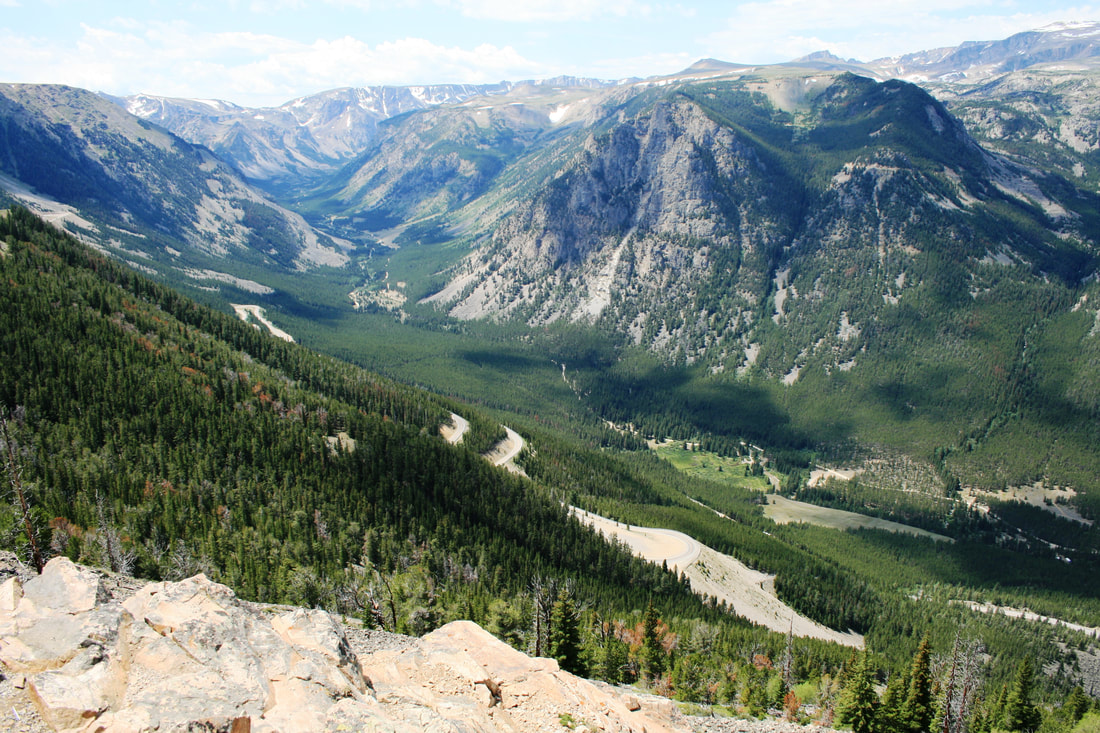
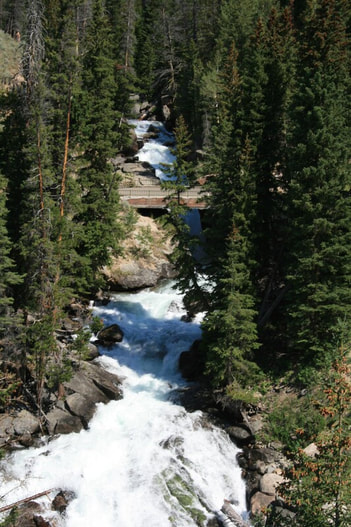
Rock Creek Canyon
The road is popular with cyclists.
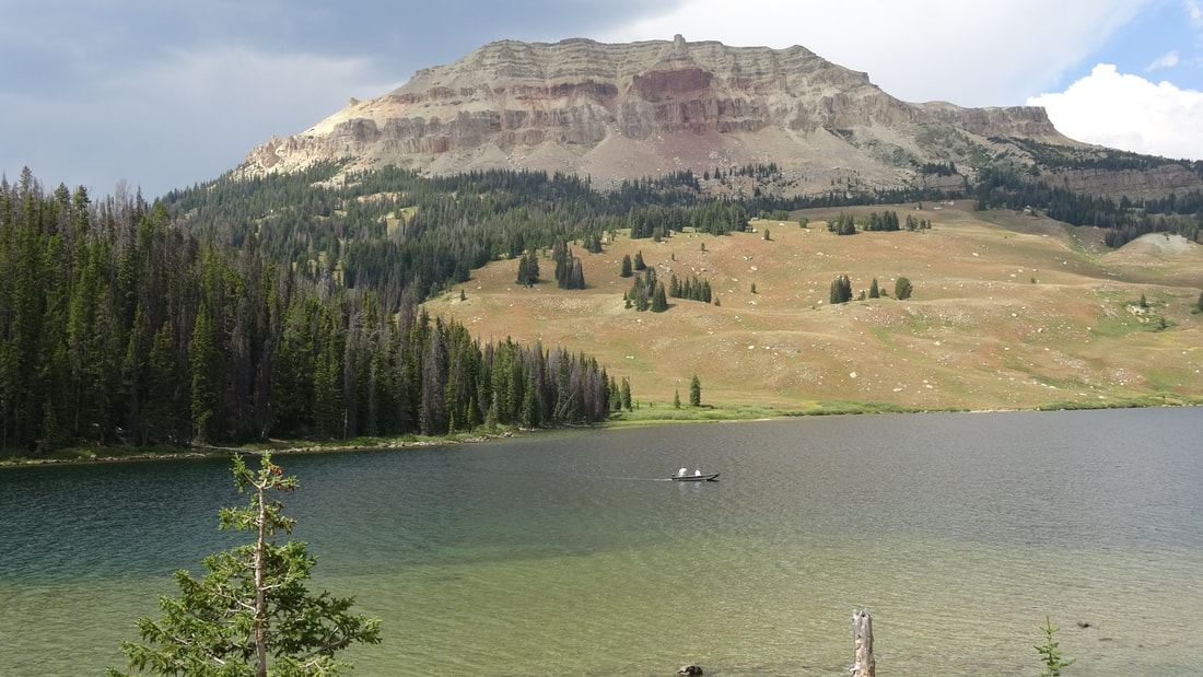
Beartooth Lake and Butte
Lake Creek
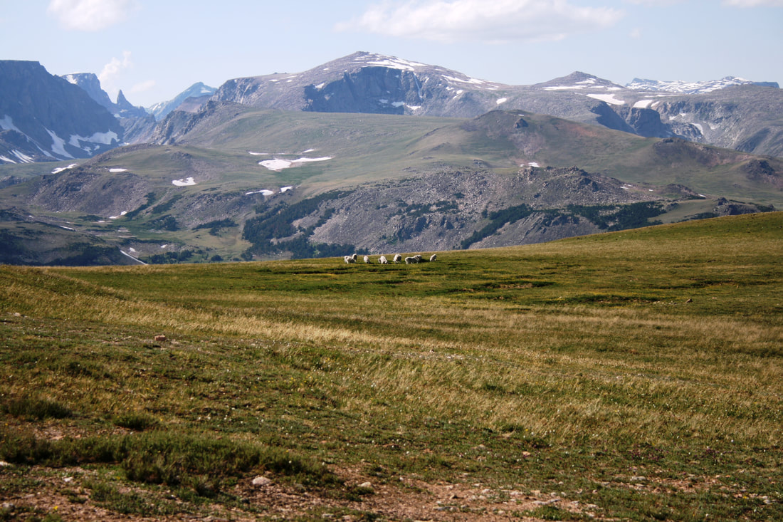
Bear's Tooth and mountain goats
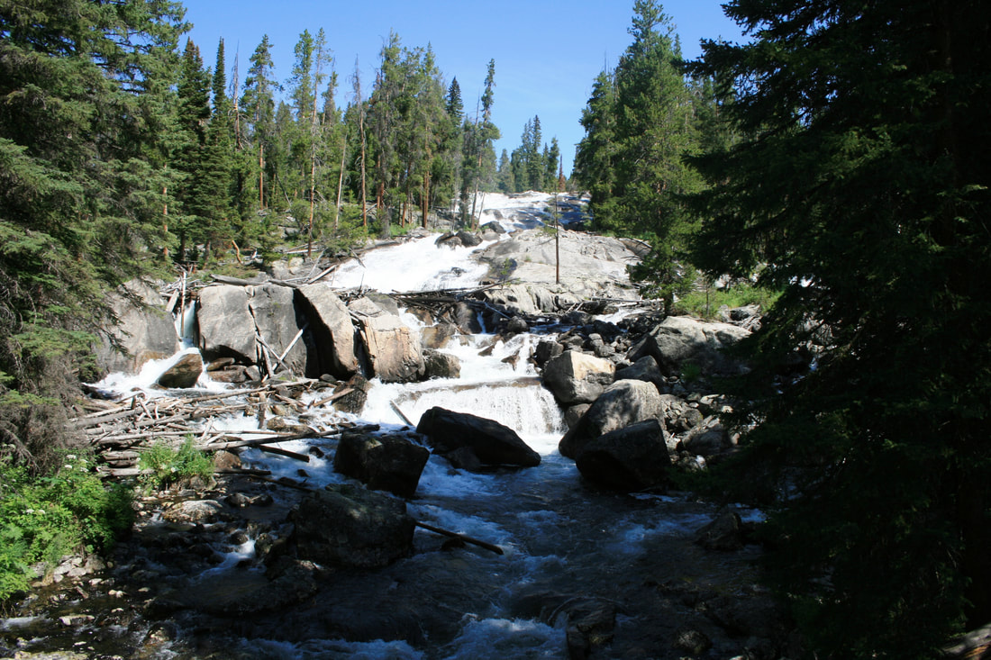
Crazy Creek
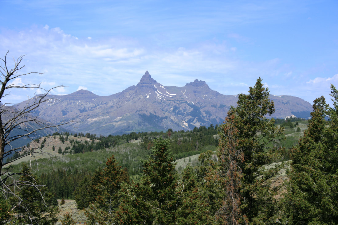
Pilot and Index Peaks
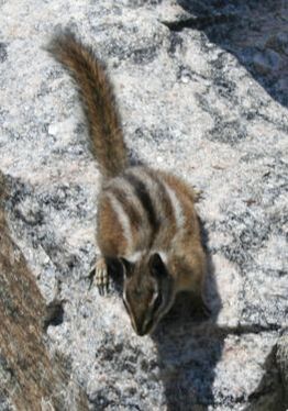
Don't be tempted to feed the chipmunks
Scenic View
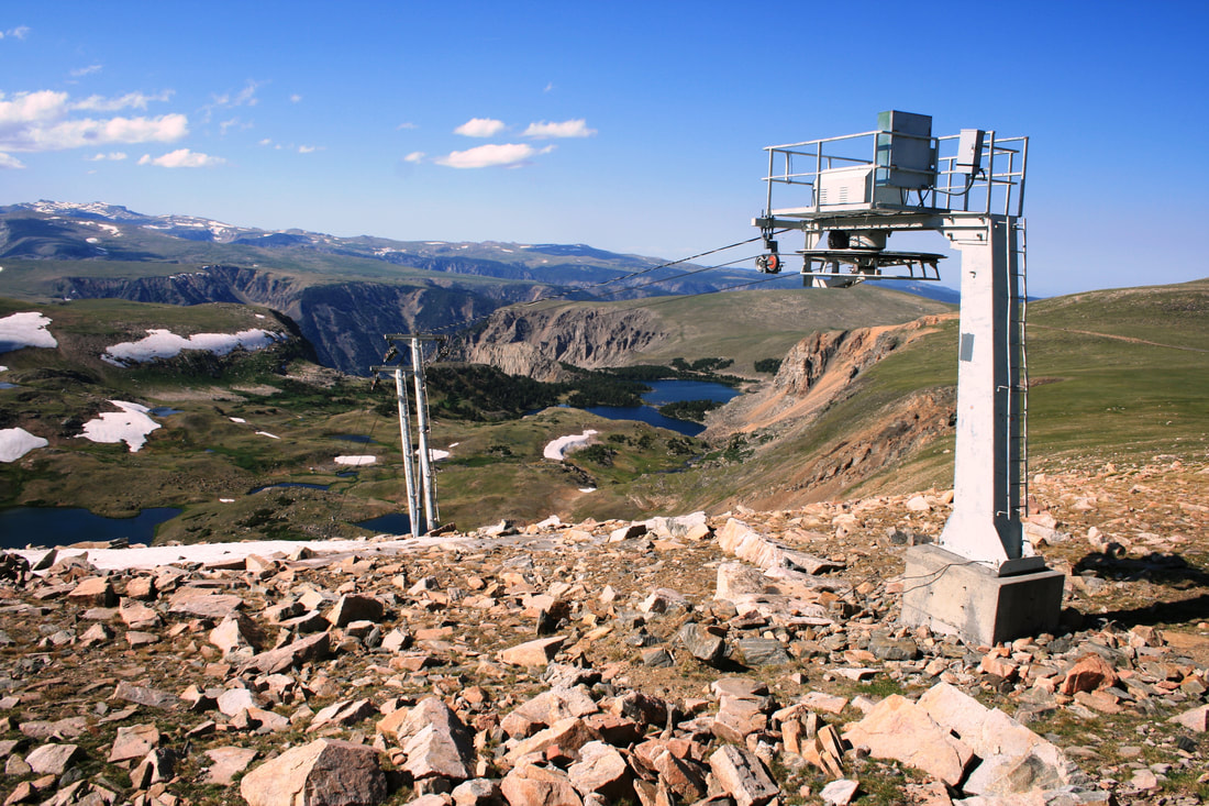
Ski Lift
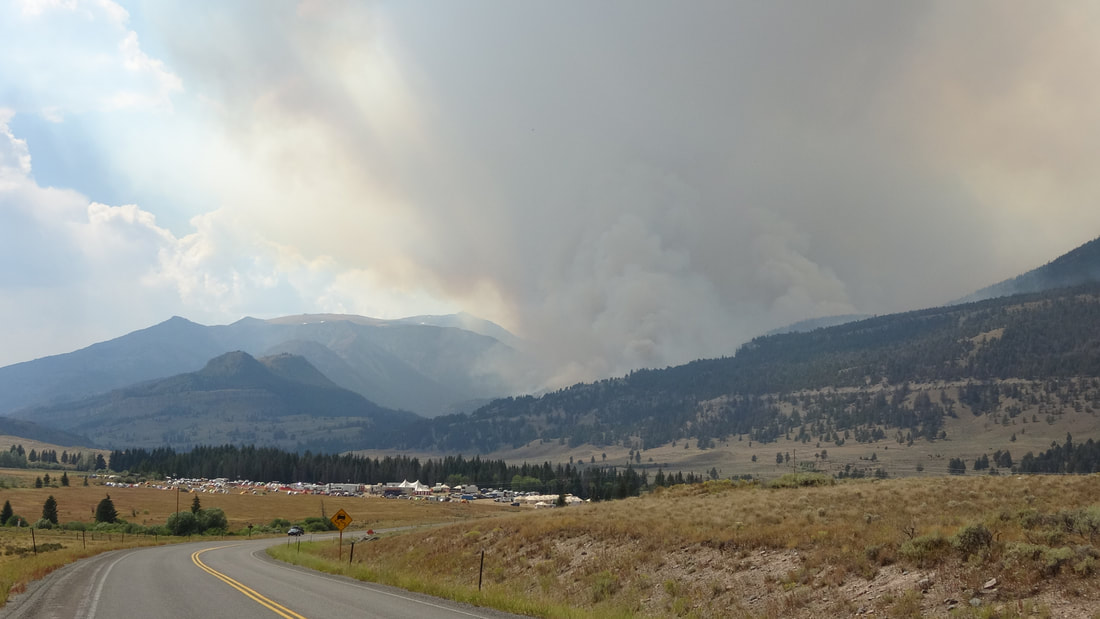
Smoke from forest fires
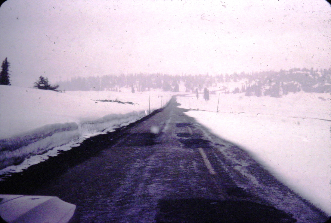
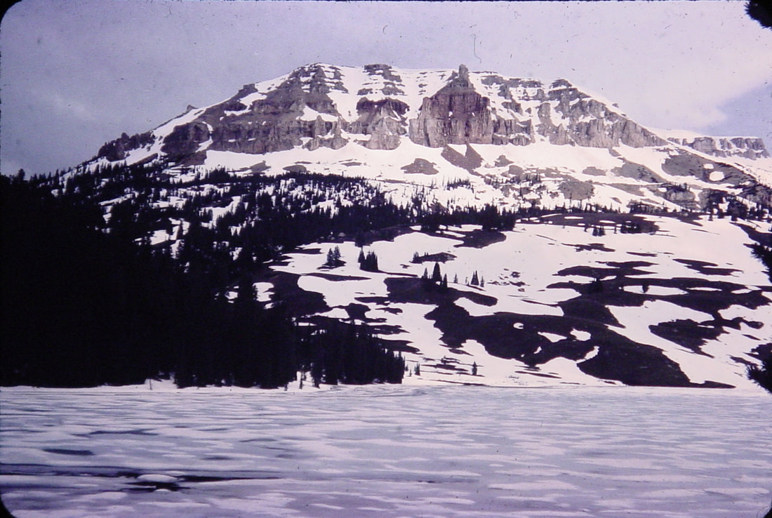
Snow blankets the roadside in 1967
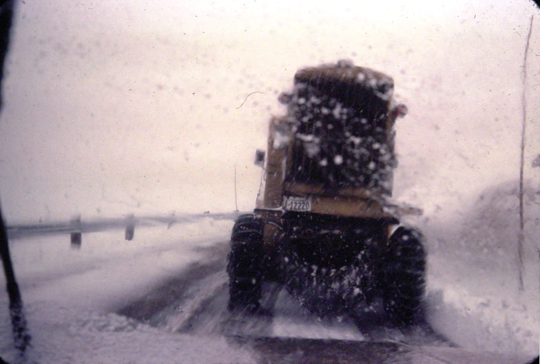
A snowplow to the rescue!
|
- Home
- Cruise/Travel
- Gigi in the 561
- Blogs
- Video
-
Explore
- Snaps >
- Island Destinations
- October Odyssey >
- Pam - Traveling in Style
-
Road Trip!
>
- Road Trip! -- Tucumcari, New Mexico
- Road Trip! -- The Painted Desert
- Road Trip! - Sedona, Arizona
- Road Trip! - Sedona Wineries
- Road Trip! Tonto Natural Bridge State Park
- Road Trip! - Mogollon Rim
- Road Trip! - Verde Canyon Railroad
- Road Trip! - Jerome, Arizona
- Road Trip! - California
- Road Trip! - Palm Springs Celebrity Tour
- Road Trip! - Palm Springs Aerial Tramway
- Road Trip! - Festival in Palm Springs
- Road Trip! - Willcox, Arizona and Apple Annie's Orchard
- Road Trip! Willcox Wineries
- Road Trip! Chiricahua National Monument
- Road Trip! Tombstone, Arizona
- Tombstone, Part Two
- Road Trip! - Epilogue
-
Traveling With Joe
>
- Beartooth Highway
- North Cascades National Park
- A Visit to the Philippines
- Grand Canyon National Park
- Glacier National Park
- Yellowstone National Park
- Hiking in Bear Country
- Crater Lake National Park
- Albuquerque Balloon Fiesta
- The Kerrville Folk Festival
- Building Hope in the Rio Grande Valley
- Yellowstone Camping Tales
-
Unknown Yellowstone
>
- Unknown Yellowstone - Heart Lake
- Unknown Yellowstone - Summit Lake
- Unknown Yellowstone - Shoshone Lake
- Unknown Yellowstone - Grizzly Lake
- Unknown Yellowstone - Riddle Lake
- Unknown Yellowstone - Pelican Cone
- Unknown Yellowstone - Mt. Washburn
- Unknown Yellowstone - Specimen Ridge
- Unknown Yellowstone - Avalanche Peak
- Unknown Yellowstone - Divide Creek
- Contact
- Search

|
© COPYRIGHT 2024 ALL RIGHTS RESERVED.
|